Rachel Naomi Remen
 |
| Sanstone Bluffs Overlook El Malpais National Monument |
While definitely tough-to-explore badlands, El Malpais National Monument is not the lifeless volcanic vastness I had expected. Rugged plants have surprisingly done their best overtaking each and every vesicle, crack, fracture, or crevasse. Enhancing with colors, smells, and textures an incredibly treacherous and challenging landscape of primeval basalt charred black from eons of slow oxidization.
El Malpais is home to some of the
oldest Douglas Fir (pseudotsuga) trees in the American Southwest, the eldest
clocking over 1,300 years! The same tricky-to-reach lava fields which have curtailed
their growth, thanks to poor growing conditions, have also protected them from
forest fires, animal (grazing) or human (logging) harm, and possibly diseases. Sadly,
the latest drought accompanied with today’s higher temperatures is killing some
trees that grew and survived 7+ centuries of wide-ranging growing conditions.
 |
| 'Pygmy Forest' at Lava Falls |
There almost wasn't an El Malpais National Monument. In the 1940’s, the area was one of the possible sites being considered by the Manhattan Project for testing the first atomic bomb. Eventually, the area near White Sands National Park was chosen as the site for the Trinity nuclear test.

While it escaped the atomic bomb, the area was used as a bombing range for pilot training during World War II. The area was handed to the Bureau of Land Management after the war, and in December 1987, it was designated as El Malpais National Monument by President Reagan and now spans 114,000 acres in the southeastern corner of the Colorado Plateau.
I spent a couple of days wandering the area from towering sandstone
bluffs to mysterious lava sinkholes and from majestic stone arches to intriguing
ropy pahoehoe. Thanks to a particularly wet monsoon season in this area of New
Mexico, it wasn’t too dry or particularly dusty.
El Malpais National Monument is part of the Zuñi-Bandera volcanic
field in west-central New Mexico. The relatively recent volcanism, combined
with the arid New Mexico climate, make El Malpais an ideal place in the
continental United States to see Hawaiian-style volcanic deposits, extensive
lava-tube systems, and associated lava-tube caves.
The Zuñi-Bandera volcanic field began erupting about 700,000 years
ago, but the El Malpais episode occurred less than 60,000 years ago. The
youngest lava flow at the national monument is 3,900 years old (a mere blink of the eye on the geologic timescale)
and represents the most recent volcanic eruption in New Mexico; this eruption
produced the McCartys flow seen at an area trail called Lava Falls.
El Malpais National Monument contains more than 290 caves in lava flows, referred to as ‘lava tubes’ or ‘lava tube caves.’ Many caves contain seasonal or perennial accumulations of ice. Some of the ice is more than 3,100 years old. Unfortunately, present-day accumulations of perennial ice appear to be at an all-time low. Normally, only a handful of caves are open to the public, but with Covid-19 and the white-nose syndrome in bats, nothing is currently open.
Today, none of this volcanic
area is active. Paleoindians probably
witnessed the last of the eruptions. Their oral history referring to ‘rivers
of fire.’ Zuñi, Acoma, Laguna, and
Navajo people all consider El Malpais an important part of their cultural
landscape. Plants are still collected
for traditional uses and ceremonies are still held here.
 |
| Lucky to be here during a wet monsoon season Tinajas (natural potholes) or ephemeral surface water pools Etched in the buff-colored Dakota sandstone Mount Taylor far away in the background |
This vast lava plain (60 x 35 miles) is bordered
to the east by a long escarpment of 96 million years old buff colored Cretaceous
Dakota sandstone, with cliffs up to 400 feet high, affording superb views of
the dark plain below. Further out and
made of 160 million years old Jurassic Zuñi Sandstone is Mount Taylor at 11,300
feet.
 |
| Entrance to lava tube cave Seasonal home to bats |
El Malpais National Monument contains 15 major lava tubes. Laid end-to-end, they
would stretch more than 100 km (60 mi). If
all intact, this tube system would the longest known lava tube system in North
America.
 |
| Pahoehoe (ropy, foreground), tachylite (glasslike, background) |
 |
| Pahoehoe, forged by fire |
 |
| Hornito (little oven) |
Enjoying this unique
landscape, it is difficult to imagine that over 150 million years ago, during
the Jurassic period, portions of this area resembled the Sahara Desert of
today.
 |
| Garrett Homestead, 1934 Reminder of America's westward expansion |
 |
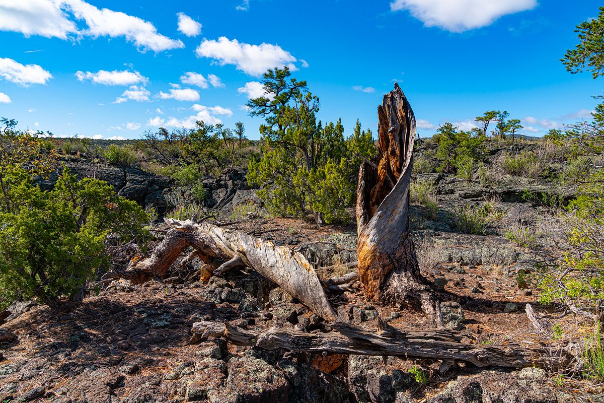
| Dead tree over lava Near Zuni Pueblo |
For the geologically inclined, this
is a rugged paradise of extreme backcountry spectacles where five distinct lava
flows lie beside and atop one another, in places reaching 475 feet thick. One of the
world’s youngest lava flows named McCartys features some of the most pristine
examples of lava formations on earth, thanks, in parts, to the really dry environment.
Thirty cinder
cones, volcanic remnants far more ancient than the main lava fields, rise along
the horizon. In other words, ‘El Malpais is like a pop-up textbook of the
magmatic forces that shaped our planet.’
 |
| La Ventana (window) Arch |
 |
| La Ventana Arch, closer look Second tallest arch in New Mexico |
 |
| Older tree remains |
E.M. Limburg, in 1990, estimated a 1% chance that some type of volcanic eruption will occur in New Mexico by 2090, and a 10% chance that an eruption will occur in the next 1,000 years. In probabilistic terms, 100 eruptions will occur in the next 1 million years. Will it be here? How will it change this landscape once more?
Finally, this area also contains a few kipukas, a Hawaiian term that refers to an ‘exposure of older rock not covered by an overlying lava flow’ or ‘an island of vegetation surrounded by lava flow’ are undisturbed areas that lava flows surrounded but did not cover. These ecological islands of vegetation create islands of native plant and animal communities. Study of the flora and fauna that thrives in the kipukas yields valuable information for restoring disturbed portions of El Malpais.

As intricate and exciting as El Malpais is, it is also a wild place with opportunities for inspiration, solitude, and personal discovery. A quiet oasis for the mind. Come visit!
On a different note, odds and ends pictures as I crisscross New Mexico.
 |
| Abiquiu, NM |
 |
| Albuquerque, NM |
 |
| Blue stem prickly poppy |
 |
| Near Deming, NM |
 |
| Nambe, NM |
 |
| Colors |
 |
| Grandfather oak in the fall |
 |
| El Malpais at night by Adam Nish, NM One of my favorite photographers |
Source: El Malpais National Monument, Geologic Resources Inventory Report, 2012/578
No comments:
Post a Comment
We are always happy to hear from you but at times it may take a while to get a reply - all depends if we have access to the internet.